Oregon Coast Hidden Gems: Tide Pools, Working Waterfronts, and Stories the Ocean Tells
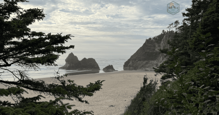
It's 6:47 AM at Seal Rock, and the retreating tide has exposed a tiered landscape of basalt shelves, each hosting its own dense neighborhood of life. A cluster of ochre sea stars grips the rock face in the splash zone. Below them, anemones retract their tentacles as they wait out low tide. In the lowest pools, ones only exposed during minus tides, a hermit crab drags its borrowed shell across purple urchin spines, and a small sculpin darts between strands of rockweed. This, however, is not Haystack Rock at sunset with 200 other visitors. Rather, this is a working intertidal zone at a time when most tourists are still sleeping, and if you know how to read what you're seeing, these rocks tell stories about wave energy, predator-prey relationships, Indigenous foodways, and why certain beaches can handle visitors while others cannot.
Rather, this guide is for travelers who want to understand how coastal ecosystems actually work - not just photograph them. You're curious about why mussels clump in dark patches, what "minus tide" means, and how maritime communities have shaped (and been shaped by) these rocky shores for millennia. You want to explore thoughtfully, leaving tide pools exactly as you found them, and you're willing to show up at odd hours with cold feet if that's what it takes to witness something remarkable.
If you're searching for Oregon Coast tide pools beyond Haystack Rock and the crowded central coast viewpoints, this guide will show you how to find quieter rocky shores, understand the marine ecology you're observing, and explore respectfully within Indigenous homelands and working waterfront communities.
Throughout this guide, I'll walk you through Oregon Coast tidepooling using my DISCOVER Framework—the 8-phase methodology I use when designing every client itinerary. You'll learn how to:
By the end, you'll have a systematic approach to tide pooling that works anywhere, not just a list of "best tide pool beaches."
We'll start with tide mechanics and timing (because showing up at high tide means seeing nothing), move through specific lesser-known locations with their ecological and cultural contexts, explore working waterfronts where fishing communities still shape the coast, and close with concrete behavioral guidance for respectful exploration. If you want a plug-and-play plan, I'll point you toward downloadable resources. If you need custom planning that accounts for your mobility, interests, and timing, I'll show you how we can work together.
Planning the Perfect Oregon Coast Tide Pool Day: Tides, Timing, and Safety
Understanding Oregon Coast Tides: Why Minus Tides Matter
First, let's understand the basics: Oregon Coast tide pools are governed by predictable tidal cycles driven by the gravitational pull of the moon and sun on Earth's oceans. On the Oregon Coast, you typically see two high tides and two low tides each day, but their heights vary dramatically based on the moon's phase and position. A "minus tide" means the water drops below average low tide - sometimes by 2-3 feet - exposing rocky shelves and pools that are usually submerged. These are your golden windows for tide pooling.
How to read a tide chart:
• Tide height is measured in feet relative to Mean Lower Low Water (MLLW). A tide of 0.0 feet is average low tide. A tide of -1.5 feet is a "minus tide" that exposes more reef.
• Plan to arrive 30-60 minutes before the predicted low tide, giving you time to walk out, explore, and retreat before water returns.
• Use NOAA tide predictions for the specific location closest to your beach—Yaquina Bay for Newport, Charleston for Cape Arago, etc. Don't assume one chart works for the entire coast.
• Avoid days with big swells or storm surf, even if tides are low. Wave energy can make rocks slippery and dangerous.
Best Seasons for Oregon Coast Tidepooling
Late Spring-Early Summer (April-June)
First, consider late spring and early summer. The best minus tides of the year typically occur in spring and early summer, often coinciding with longer daylight hours. You'll get -1.0 to -2.0 foot tides in late afternoon or early morning, with water temperatures still cold but manageable. This is peak season for seeing the widest diversity of organisms without winter storm danger.
Fall (September-October)
Fall offers a second window of good minus tides, though often in early morning. Weather can be more variable - prepare for wind and rain. Marine life is still active, and you'll encounter far fewer tourists than in summer.
Winter (November-February)
Winter minus tides happen during daylight hours, but wave energy and storm surf make tidepooling risky. If you're experienced and cautious, winter offers dramatic storm-watching from high viewpoints - not from exposed rock platforms. Save winter for maritime museums and clifftop overlooks rather than hands-on tidepooling.
 Tide Pool Safety Essentials
 Tide Pool Safety Essentials
Tide pooling is low-risk if you're prepared and attentive...but people are swept off rocks every year. Respect the ocean's power. Never turn your back on the ocean.

Want a plug-and-play tidepooling day plan? Download the Oregon Tide Pool Field Notebook with:
Oregon Coast Tide Pool Hidden Gems: Beyond Haystack Rock
The most famous Oregon Coast tide pools (Haystack Rock in Cannon Beach, Yaquina Head in Newport) are famous for good reason: they're accessible, well-interpreted, and ecologically rich. They're also crowded, especially in summer. However, if you want a quieter experience with equally impressive marine life, consider these lesser-known rocky shores.
Seal Rock State Recreation Site: Tiered Basalt Shelves
Tiered basalt shelves at Seal Rock showing Oregon Coast tide pool zonation patterns
Seal Rock features dramatic basalt formations creating tiered rocky shelves at different elevations. Each tier represents a different intertidal zone - splash zone at the top, high intertidal, mid-intertidal, and low intertidal - making this an excellent natural laboratory for understanding how immersion time shapes community composition. You'll see clear "bands" of barnacles, mussels, sea stars, and anemones as you work your way down. This makes Seal Rock one of the best Oregon Coast tide pools for learning intertidal ecology.
 General Location: Approximately 10 miles south of Newport on Highway 101
GPS Coordinates: 44.4983° N, 124.0736° W (parking area)
Parking: Large paved lot with restrooms and picnic tables
Trail: 100-yard walk on paved path, then descend wooden stairs to beach level (approximately 40 steps - not wheelchair accessible)
Beach Surface: Mix of sand and exposed basalt at low tide
Best Conditions:
Here, you can look for textbook examples of intertidal zonation. In the high intertidal (only wet during high tide), you'll see barnacles clustered densely. Move lower and you'll find mussel beds, ochre sea stars (the famous orange/purple ones), and aggregating anemones. The lowest pools - only exposed during strong minus tides - host urchins, chitons, and sometimes small fish like tide pool sculpins.
Seal Rock is also a nesting site for seabirds. Respect any roped-off areas and keep noise low during breeding season (April-July).
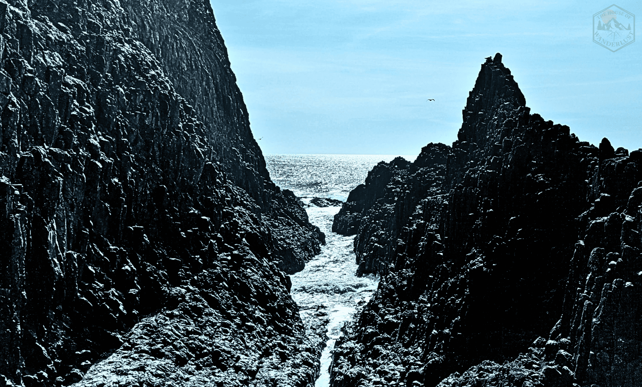
Cape Arago & Simpson Reef: Ecology + Marine Mammal Viewpoints
Oregon Coast tide pools at Cape Arago with diverse marine life and intertidal organisms.
Cape Arago offers tiered access: a high clifftop viewpoint for watching sea lions and harbor seals on Simpson Reef (no climbing required), and a lower tidepooling area on the north cove with extensive rocky intertidal habitat. Marine educators use Cape Arago for formal Oregon Coast tide pool lessons because of its species diversity and clear zonation patterns.
The connection between marine mammals, fish populations, and Indigenous Coos, Lower Umpqua, and Siuslaw foodways is significant here. These were (and remain) important harvest areas, and visitors should approach with that awareness.
General Location: Southwest of Coos Bay, end of Cape Arago Highway
GPS Coordinates: 43.3086° N, 124.3956° W (Simpson Reef Viewpoint)
Parking: Paved lots at both upper viewpoint and lower north cove access
Trail: Upper viewpoint is fully paved and wheelchair accessible. Lower tide pool access involves steep trail and stairs.
Beach Surface: Rocky reef with tide pools
Best Conditions:
Similarly, at the north cove, look for sea stars in multiple colors (ochre, purple, and smaller six-rayed stars), large green anemones in deeper pools, chitons clinging to rock faces, and extensive mussel and barnacle beds. Listen for the sea lions barking from Simpson Reef - their presence indicates healthy fish populations and ocean productivity.
Avoid walking on mussel beds; mussels are filter feeders that improve water quality, and crushing them damages both the organism and the substrate other animals depend on.
Neptune State Scenic Viewpoint: Accessible Interpretive Experience
In contrast, Neptune offers a gentler introduction to tide pooling with a shorter walk and interpretive signage explaining intertidal ecology. It's quieter than Yaquina Head but still provides excellent access to diverse marine life. The beach here features a mix of sandy areas and rocky outcrops, giving you flexibility in where you explore based on wave conditions.
📍General Location: 3 miles south of Yachats on Highway 101
GPS Coordinates: 44.2794° N, 124.1156° W
Parking: Small paved lot with restrooms
Trail: Short trail (under 5 minutes) descending to beach level, mix of stairs and switchbacks
Beach Surface: Sandy beach with rocky tide pool areas
Best Conditions:
Neptune's interpretive signs help you identify common species and understand ecological relationships. Look for hermit crabs (you can even watch them switch shells if you're patient), purple shore crabs hiding under rockweed, and limpets that return to the exact same spot on the rock after feeding. This "homing" behavior is a fascinating adaptation to wave stress.
Note the differences between exposed rock faces (dominated by barnacles and mussels that can handle wave impact) and protected pools (hosting more delicate anemones and soft-bodied invertebrates).
Otter Point State Recreation Site: South Coast Quiet
Otter Point sits just north of Gold Beach on the quieter southern Oregon Coast. This small rocky headland features accessible tide pools with less visitor pressure than central coast locations. The site offers a unique combination of sheltered coves and wave-exposed points, allowing you to observe how the same species adapt to different wave energy levels within a few hundred feet.
📍General Location: 1 mile north of Gold Beach on Highway 101
GPS Coordinates: 42.4417° N, 124.4214° W
Parking: Small pullout with limited spaces (arrive early)
Trail: Very short walk (2-3 minutes) on dirt path to rocky shore
Beach Surface: Rocky headland with small sandy coves
Best Conditions:
Otter Point is excellent for comparing microhabitats. The wave-facing rocks host dense barnacle and mussel communities with sea stars hunting between them. Walk around to the protected side and you'll find deeper pools with more delicate organisms: nudibranchs (sea slugs), small crabs, and anemones in multiple colors. This side-by-side comparison teaches you to "read" wave exposure just by looking at organism distribution.
For photographers, Otter Point offers some of the most photogenic Oregon Coast tidepools with dramatic rock formations and excellent light. The south coast position also means slightly warmer water temperatures, occasionally hosting species more common in California waters.
These four locations represent different access levels, ecological features, and visitor pressures. Choose based on your mobility, timing, and what you most want to learn. If you're unsure which site matches your interests and physical capabilities, this is exactly what my Basic Planning Consultation addresses - we'll match locations to your goals and build a realistic day plan.
Reading the Intertidal: Ecology for Curious Explorers
Once you arrive at your chosen location, you'll quickly notice that Oregon Coast tide pools aren't just random chaos - they're highly organized systems shaped by immersion time, wave energy, predation pressure, and competition for space. Once you understand the patterns, every tide pool becomes a readable story about who lives where and why.
Oregon Coast Tide Pool Zonation: Bands of Life
To visualize this, imagine the intertidal as a series of horizontal bands, each defined by how long it spends submerged versus exposed to the air. Organisms in each band have evolved specific adaptations to handle their particular conditions.
🌊 Four Intertidal Zones
SPLASH ZONE (above high tide line)
HIGH INTERTIDAL (covered only during high tide)
MID INTERTIDAL (covered ~50% of the time)
LOW INTERTIDAL (almost always submerged)

Diagram, courtesy of the Oregon Sea Grant at the Hatfield Marine Science Visitor Center of Oregon State University (https://seagrant.oregonstate.edu/visitor-center/marine-education/lab-and-field-experiences/rocky-intertidal-ecology), showing Oregon Coast tide pool zones from splash zone to low intertidal,
As a result, understanding these zones transforms how you experience Oregon Coast tide pools - you're no longer just looking at colorful creatures, you're reading a complex ecological story written in vertical bands.
Key Oregon Coast Tide Pool Species & Their Adaptations
Now that you understand where organisms live, let's explore who lives there and why.
Common Intertidal Predators
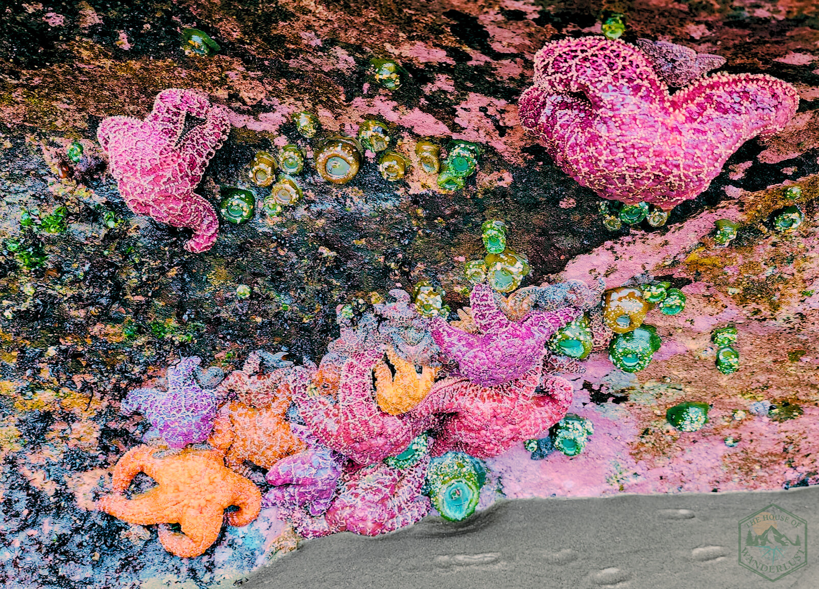
Ochre Sea Stars (Pisaster ochraceus)
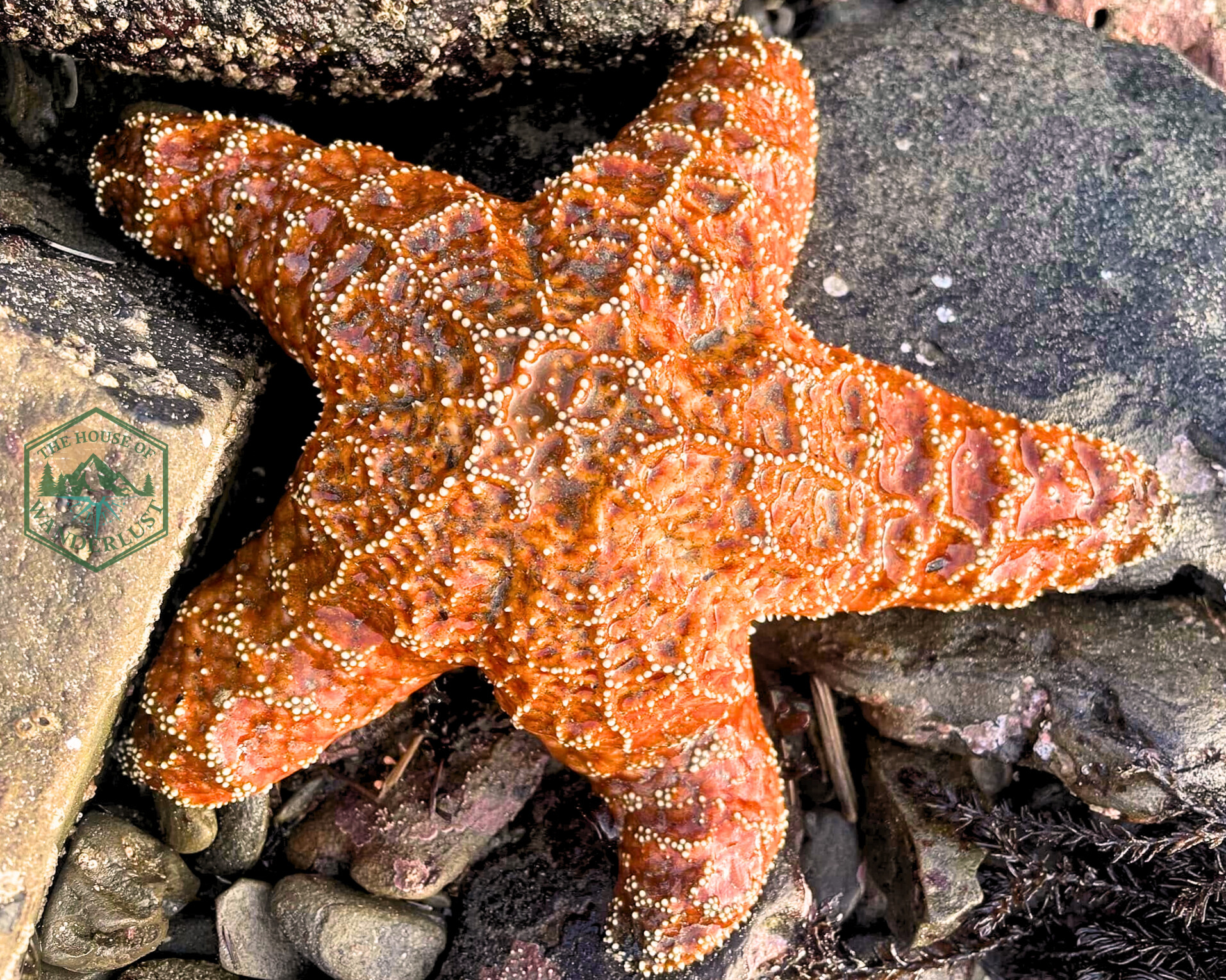
Ochre sea stars in Oregon Coast tide pool, clinging to rocks during low tide.
Sea stars are the organisms that most visitors think of when they picture Oregon Coast tide pools. These iconic orange, purple, or yellow sea stars are keystone predators - meaning they have an outsized effect on ecosystem structure relative to their abundance. Ochre stars eat mussels, and without sea star predation, mussels would dominate the mid-intertidal, excluding other species. Sea stars move using hundreds of tiny tube feet with suction-cup tips, and they can pry open mussels by exerting constant pressure for hours.
Therefore, when you see a sea star, you're looking at ecosystem regulation in action.
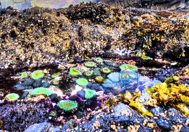
Aggregating Anemones (Anthopleura elegantissima)
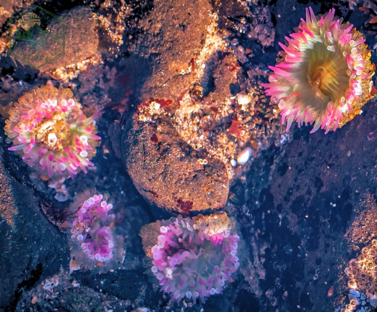
Aggregating anemones in Oregon Coast tide pools, with tentacles extended.
These small green anemones (colored by symbiotic algae inside their tissues) clone themselves, creating dense carpets of genetically identical individuals. They can recognize genetic relatives and will peacefully coexist with clones, but they'll fight non-relatives by stinging them with specialized cells. During low tide, they retract their tentacles and cover themselves with shell fragments and sand for protection.
Anemones are stationary carnivores that paralyze small prey with stinging cells on their tentacles.
Filter Feeders and Shell Dwellers
California Mussels (Mytilus californianus)
Mussels attach to rocks using strong protein threads called byssal threads, allowing them to withstand pounding wave energy. They feed by filtering plankton from seawater - a single mussel can filter several liters per day, making mussel beds important for water quality. Mussels often form thick mats in the mid-intertidal, creating habitat for smaller animals that live among the shells.
For this reason, never pry mussels off rocks or walk on mussel beds; you're crushing both the mussels and the hidden community living below them.
Hermit Crabs
Hermit crabs don't grow their own shells - they scavenge empty snail shells and move into larger ones as they grow. Watch a hermit crab for a few minutes and you might see it test a new shell, checking size and weight before committing to the move. This behavior is a beautiful example of resource limitation and decision-making in invertebrates.
Empty shells on the beach aren't "souvenirs" - they're future hermit crab homes. Leave them where you find them.
Chitons
These armored oval creatures cling to rocks so tightly you can barely pry them off (and you shouldn't try). Chitons have eight overlapping shell plates that give them flexibility to conform to uneven rock surfaces while maintaining protection. They feed by scraping algae and microorganisms off rocks with a radula (a ribbon-like tongue covered in tiny teeth). Most chitons are nocturnal, so if you find them during the day, they're hunkered down waiting for nightfall.
The "footprint" a chiton leaves on the rock - a lighter oval mark - shows where it returns to rest after feeding.
This is the "S - Stratify Experience Layers" phase of the DISCOVER Framework in action. You're not just seeing tide pools, you're understanding the ecological layer (predator-prey relationships, adaptations, competition), the scientific layer (how wave energy and immersion time shape communities), and your own learning layer (what you're discovering about complexity and interconnection). This depth transforms tidepooling from photo collection into genuine exploration.
Working Waterfronts: Maritime History and Coastal Communities
Beyond the ecological story, Oregon Coast tide pools don't exist in isolation from human communities. The same ocean that shapes rocky intertidal ecosystems has shaped the livelihoods, economies, and cultures of Oregon Coast towns for millennia. Understanding working waterfronts - the places where people harvest, process, and ship seafood - adds a crucial layer to your coastal exploration.
Case Study: Astoria's Columbia River Maritime Heritage
Astoria, where I'm based, sits at the confluence of the Columbia River and Pacific Ocean - one of the most treacherous river bars in the world, earning the nickname "Graveyard of the Pacific." For over 10,000 years, Chinook and Clatsop peoples harvested salmon, sturgeon, and shellfish from these waters. Euro-American settlement brought fur trading, followed by salmon canneries that processed millions of pounds of fish annually in the late 1800s and early 1900s.
Today, however, while commercial fishing does continue, it is an industry dramatically reduced from historical levels. Walking Astoria's waterfront, though, you are able to see the layered history: Chinook fishing grounds, 19th-century cannery pilings, modern fish processing facilities, and maritime museums interpreting centuries of change.

Situated where the mouth of the Columbia River meets the Pacific Ocean, Astoria is an Oregon Coast harbor that supports communities connected to tide pool ecosystems.
Consequently, this impacts Oregon Coast tide poolers:
Other Coastal Working Ports Worth Your Time
Active Commercial Fishing Ports
Newport
Home to Oregon's largest commercial fishing fleet, Newport's bayfront remains an active working waterfront with fish processing, marine research institutions (including OSU's Hatfield Marine Science Center), and tourism happily coexisting next to one another. The Oregon Coast Aquarium and Hatfield Center offer excellent tide pool education, and the bayfront's cannery-era buildings tell stories of boom-and-bust fishing economies.
Charleston
By contrast, Charleston Harbor feels less polished than Newport - and that's kind of the point. This is a working harbor where crab boats, charter fishing vessels, and commercial fishers still dominate. The Charleston Marine Life Center offers small-scale tide pool touch tanks and education, and the harbor itself is worth walking just to watch boat traffic and read the community bulletin boards advertising deck hand positions and boat repairs.
Small-Scale Working Harbors
Garibaldi
Just north of Tillamook Bay, Garibaldi remains authentically blue-collar - a working port where commercial crabbing and charter fishing dominate over tourism. The harbor is small enough that you can watch boats unload their catch, and the few restaurants here source directly from the fleet. Walking the docks feels like stepping back decades; you'll see boat repair in progress, nets being mended, and fishers doing actual work rather than performing for visitors.
When you visit these ports, look for small maritime museums, historical societies, and visitor centers that interpret fishing history, navigation challenges, and cannery operations. Ask where local fishers eat breakfast. Buy from businesses that still serve the working waterfront, not just tourists.
This is "C - Curate Authentic Connections" in practice: you're connecting with the human communities whose livelihoods depend on the same ocean you're exploring recreationally.
Supporting Maritime Heritage
 Supporting Maritime Heritage
When you visit Oregon Coast communities:
Your tourism dollars can support preservation of working waterfront culture - or they can displace it. Choose intentionally.
Feeling Overwhelmed by Tides, Timing, and Logistics?
Planning a tide pooling day requires coordinating NOAA tide charts, weather forecasts, seasonal timing, GPS coordinates, safety considerations, and backup plans for weather changes. It's doable on your own, but it takes time and local knowledge.
My Basic Planning Consultation (60-90 minutes, $150/hour) gives you a custom tide pool + coastal history day plan including:
Book a consultation and I'll turn your research overwhelm into a clear, executable plan.
Indigenous Homelands and Coastal Stewardship
The Oregon Coast is Indigenous land, present tense. The rocky shores you explore, the marine life you observe, and the maritime communities you visit all exist within the homelands of Chinook, Clatsop-Nehalem, Tillamook, Coquille, Confederated Tribes of Siletz Indians, Coos, Lower Umpqua, Siuslaw, Tolowa Dee-ni', and other Nations and Bands. These are not background facts - they are the foundation of responsible coastal exploration. When you explore Oregon Coast tide pools, you're walking through Indigenous homelands with thousands of years of stewardship history.
Historically, for millennia, Indigenous peoples of the Oregon Coast have practiced sophisticated resource management of intertidal zones, harvesting shellfish, seaweed, and fish in seasonal rounds that aim to sustain both human communities and marine ecosystems. Tidepooling as recreational tourism is a recent development, and we're collectively still learning how to do it without causing harm.
General Culture Protocols for Tide Pool Visitors
Ultimately, moving through the coast with awareness of ongoing Indigenous presence and stewardship shifts your mindset from "discovering" (implying these places were unknown) to "being welcomed as a guest." Tidepooling becomes an act of relationship rather than extraction.
Resources to Learn More
Indigenous-led nonprofit platform offering an interactive map of global Indigenous territories, languages, and treaties. It highlights overlapping territories to challenge colonial perspectives and foster awareness of Indigenous histories and relationships to land.
Travel Oregon's "Guide to Oregon Indian Country" is a collaborative resource with the state's nine federally recognized tribes, highlighting tourism on tribal lands. It profiles each tribe, their histories, and attractions like museums, casinos, outdoor activities, and public events.
This Oregon Department of Education guide lays out nine core "Essential Understandings" to support the state's Tribal History/Shared History curriculum on Native Americans in Oregon. It covers topics like tribes' presence since time immemorial, their sovereignty, history, governments, identity, lifeways, languages, treaties, and federal policies including genocide.
Individual Tribal Nation Websites -
Always check the website of the specific Nation whose territory you're visiting for public programs, cultural protocols, and current events.
Leave No Trace and Oregon Coast Tide Pools: Rocky Intertidal Zone Guidelines
Leave No Trace principles were developed primarily for backcountry wilderness, but they translate directly to Oregon Coast tide pools, albeit with some coastal-specific adaptations. Nevertheless, the goal is the same: minimize your impact so future visitors can have the same experience you're having.
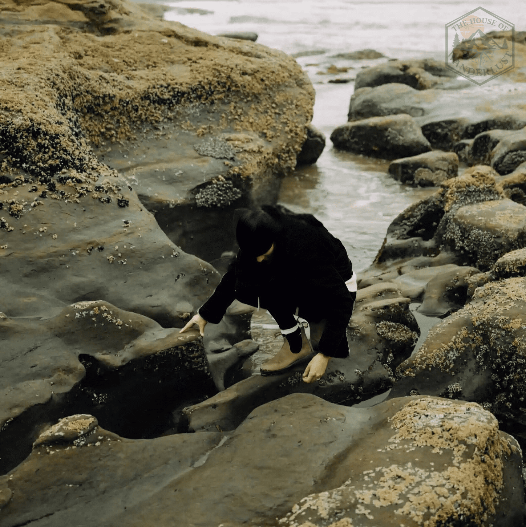
Visitor observing Oregon Coast tide pools responsibly, without touching marine life.
Seven Principles for Oregon Coast Tidepooling
Preparation and Physical Impact
1. Plan Ahead and Prepare
Check tide charts, weather, and swell forecasts before you go. Bring appropriate footwear (closed-toe shoes with tread), layers for wind and cold, water, snacks, and a first-aid kit. Know your physical limits and choose access points that match your mobility. Planning prevents damage from people getting stranded, injured, or making poor decisions under stress.
2. Travel and Camp on Durable Surfaces
Walk only on bare rock and sand - never on living organisms. Barnacles, mussels, anemones, and algae are all "surfaces" that can be crushed underfoot. Step carefully, watch where you place your feet, and avoid jumping from rock to rock. If you're carrying children, keep them close and teach them the same rule: "If it's alive, we don't step on it." Additionally, do not build rock stacks or cairns. These disrupt microhabitats and can collapse on tide pool organisms.
Waste and Resource Management
3. Dispose of Waste Properly
Pack out everything you bring in. Do not leave food scraps, even biodegradable items like apple cores - these introduce nutrients and attractants that alter animal behavior. If you need to use the bathroom, return to the parking area or use designated facilities. Never urinate or defecate on the beach or in tide pools.
4. Leave What You Find
Do not remove shells, rocks, organisms, or driftwood. Empty shells are future hermit crab homes. Rocks provide habitat and structure. Living organisms belong where they are. This includes "rescuing" stranded animals - most tide pool organisms can handle low tide; moving them usually causes more stress than it prevents. Furthermore, do not rearrange rocks to "make better pools" or flip over rocks to see what's underneath. If you carefully lift a rock to observe the underside, return it to its exact original position immediately.
5. Minimize Campfire Impacts
Not applicable to tidepooling, but relevant if you're combining tide pools with beach camping: use designated fire rings only, burn only driftwood from above the high tide line, and never burn driftwood with creatures living on or in it. Remember that dune grass is highly flammable, and protected in some areas.
Respecting Wildlife and Community
6. Respect Wildlife
Observe animals without touching, chasing, or feeding them. Sea stars, anemones, and crabs are not toys - they're living organisms experiencing stress during low tide. If an animal retreats or closes up when you approach, you're too close. Keep dogs leashed and under control. Dogs chasing shorebirds or disturbing tide pools create significant stress for wildlife. Do not use flash photography directly on light-sensitive organisms like anemones.
7. Be Considerate of Other Visitors
Keep group sizes small to reduce cumulative impact on tide pool zones. If another group is already exploring a pool, wait or choose a different area. Overcrowding damages habitat and reduces everyone's experience quality. Keep voices low. Tide pooling is often a meditative, quiet activity, and loud groups disrupt that for others. If you're teaching children, model respectful behavior explicitly. Kids learn by watching adults.
Leave No Trace isn't a rigid set of rules - it's a framework for thinking about impact. The question is always: "Will my action leave this place exactly as I found it, so the next visitor (and the organisms living here) experience it unchanged?" If the answer is no, don't do it.
Finding Authentic Coastal Food: Beyond the Tourist Traps
After a morning exploring Oregon Coast tide pools, you'll be cold, wet, and hungry. The Oregon Coast has no shortage of restaurants, but finding the ones where locals actually eat - the places serving fishers' breakfasts at 5:30 AM or making chowder with fish landed that morning - requires different navigation than Yelp alone.
Strategies for Finding Family-Run Coastal Eateries
Importantly, while I am open about my stance against gatekeeping, I'm intentionally not naming specific restaurants here because one, small businesses change ownership and quality , and two, part of the joy of this approach is the discovery process. You're learning how to read a place, not following a pre-made list.
This is "I - Investigate Hidden Opportunities" applied to food: you're using local knowledge, observational cues, and systematic questions to find authentic experiences.
🍽️ Questions to Ask Locals
When you meet a ranger, museum docent, or shop owner, try:
People who live and work on the coast are usually happy to share recommendations, and they'll appreciate that you're asking thoughtfully rather than defaulting to Google.
Accessible Oregon Coast Tide Pool Learning: Viewpoints and Other Alternatives
Not everyone can (or wants to) clamber over slippery rocks at 6 AM. Mobility limitations, sensory sensitivities, chronic illness, injury, age, and personal preference all shape how you can explore the coast. Fortunately, Oregon Coast tide pool ecology can be learned and appreciated through multiple access points.
Accessible Viewpoints and Interpretive Sites
Indoor Alternatives: Aquarium and Marine Science Centers
When weather is bad, tides are wrong, or mobility is limited, indoor facilities offer excellent tide pool education:
Indeed, these aren't "second-best" options - they're different learning modalities. Touch tanks allow you to observe behaviors (like sea star tube feet or anemone feeding) that would be difficult or inappropriate to see on the beach. Indoor exhibits provide controlled environments where you can ask questions and learn at your own pace.
Planning for Specific Accessibility Needs
If you or someone you travel with uses mobility aids, manages chronic pain, has sensory sensitivities, or requires specific accommodations, call ahead to ranger stations and visitor centers. Generic website descriptions often miss crucial details like:
Often, staff can provide nuanced information and recommendations that makes the difference between a successful visit and a frustrating one.
Accessibility isn't an afterthought in the DISCOVER Framework. Rather, it's integrated into "D - Define Your Adventure Profile." Your physical capabilities, sensory preferences, and energy levels shape every subsequent decision. An itinerary that ignores accessibility isn't just inconvenient; it's poorly planned.
Putting It All Together: DISCOVER Framework Applied
At this point, you've just worked through a complete tide pool planning process using the DISCOVER Framework. Let's recap what you've learned:
-
D - Defined your Oregon Coast tide pool goals (ecology learning, quiet observation, photography, or cultural context)
-
I - Investigated tide charts, seasonal timing, and specific locations beyond the obvious spots
-
S - Stratified experience layers across ecology (zonation, species adaptations), history (working waterfronts, maritime heritage), and culture (Indigenous stewardship, current fishing communities)
-
C - Curated authentic connections by supporting maritime museums, eating at local eateries, and respecting Indigenous protocols
-
O - Optimized logistics including parking, trail access, safety considerations, and accessibility factors
-
V - Validated through Leave No Trace principles and responsible wildlife observation
-
E - Executed with flexibility for weather, tides, and alternative learning opportunities
-
R - Reflected (which you'll do after your trip) on what you learned, what surprised you, and how you'll apply this systematic approach to future exploration

Moreover, this methodology works for any Oregon Coast experience - not just tide pooling. Once you understand how to Define, Investigate, Stratify, Curate, Optimize, Validate, Execute, and Reflect, you can apply it to forest hikes, coastal towns, scenic drives, or multi-day expeditions.
Ready for a Fully Planned Oregon Coast Experience?
Alternatively, if this guide helped you understand tide pool planning but you're thinking "I want someone to handle all of this for me," that's exactly what my Comprehensive Planning service does.
Comprehensive Planning ($1,200-$2,500)
For travelers who want complete peace of mind and a multi-day Oregon Coast immersion with full DISCOVER Framework implementation:
People who live and work on the coast are usually happy to share recommendations, and they'll appreciate that you're asking thoughtfully rather than defaulting to Google.
 In-depth adventure profile development (your interests, mobility, timing, budget)
Extensive hidden gem research across tide pools, trails, cultural sites, and local eateries
Detailed day-by-day itinerary with alternatives for weather changes
All logistics coordination and recommendations (lodging, restaurants, parking, accessibility)
Cultural immersion opportunities and local connections
Interactive digital itinerary accessible on phone/tablet
Pre-departure briefing covering safety, tides, and protocols
Email support leading up to your trip
Post-trip debrief to discuss what worked and what you'd change
This service is ideal for first-time Oregon Coast visitors, special occasions, families with diverse needs, or travelers who prioritize authentic cultural experiences and want expert coordination.
Timeline: 4-6 weeks from engagement to final itinerary delivery
Meanwhile, for complex trips requiring real-time support during your adventure - like storm season visits with road closure risks or multi-week expeditions across the entire coast - Premium Concierge Service ($3,500-$5,000) includes everything in Comprehensive Planning plus 24/7 support, on-trip itinerary adjustments, weather contingency planning, and VIP coordination.